Maps of Franklin & the Region
Chester County Townships in 1712
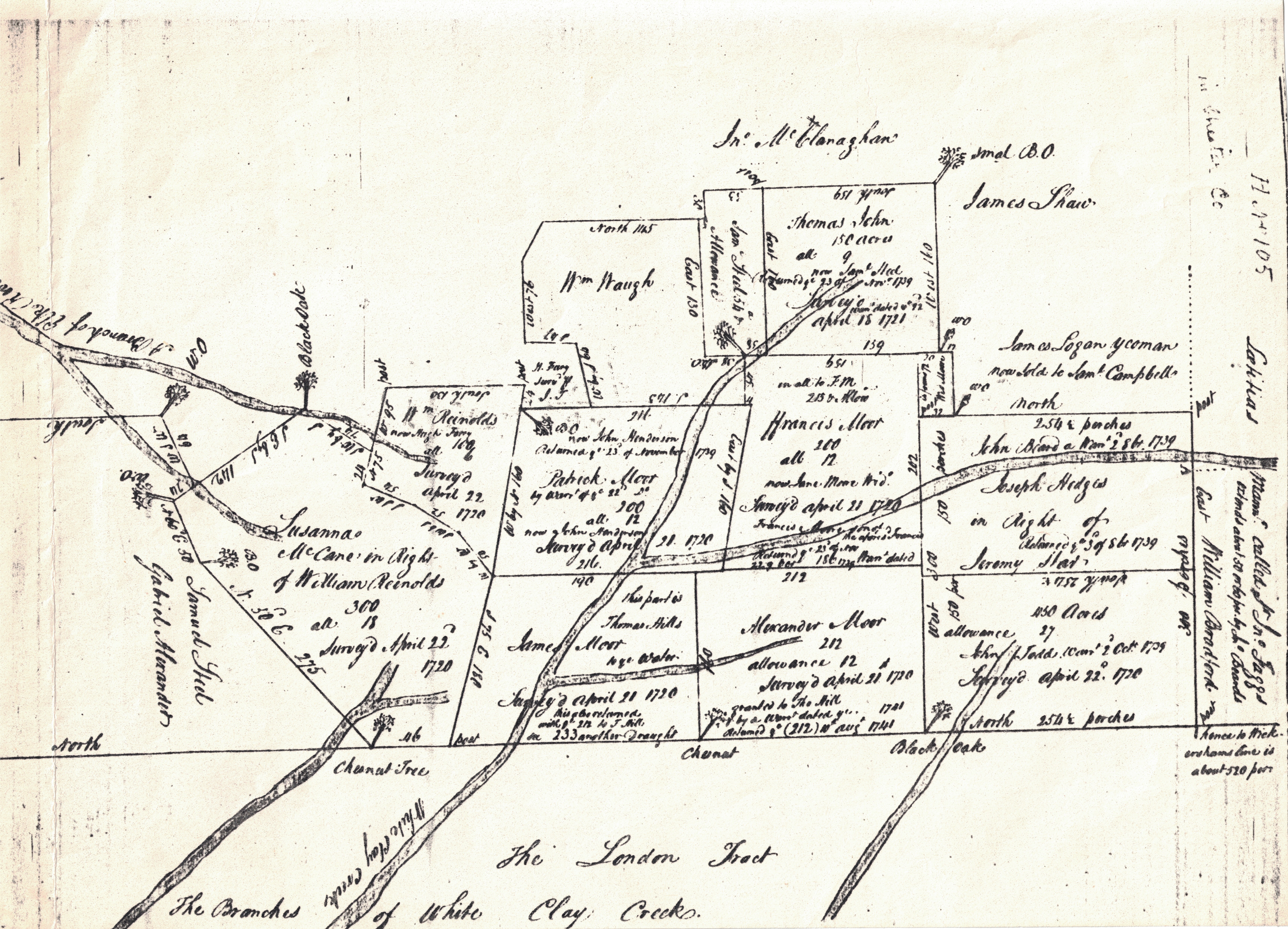
Properties Now in E New London & W Franklin Townships, 1720s
Properties Now in E New London & W Franklin Townships, 1720s

From the Chester County Archives on line.
Properties Now in E New London & W Franklin Townships, 1720s
Properties Now in E New London & W Franklin Townships, 1720s
Properties Now in E New London & W Franklin Townships, 1720s
North on this map is to the right; from the New London Area Historical Society.
New London Properties, c.1720
Properties Now in E New London & W Franklin Townships, 1720s
Detail of Susanna McCane's Lands, Early 1700s
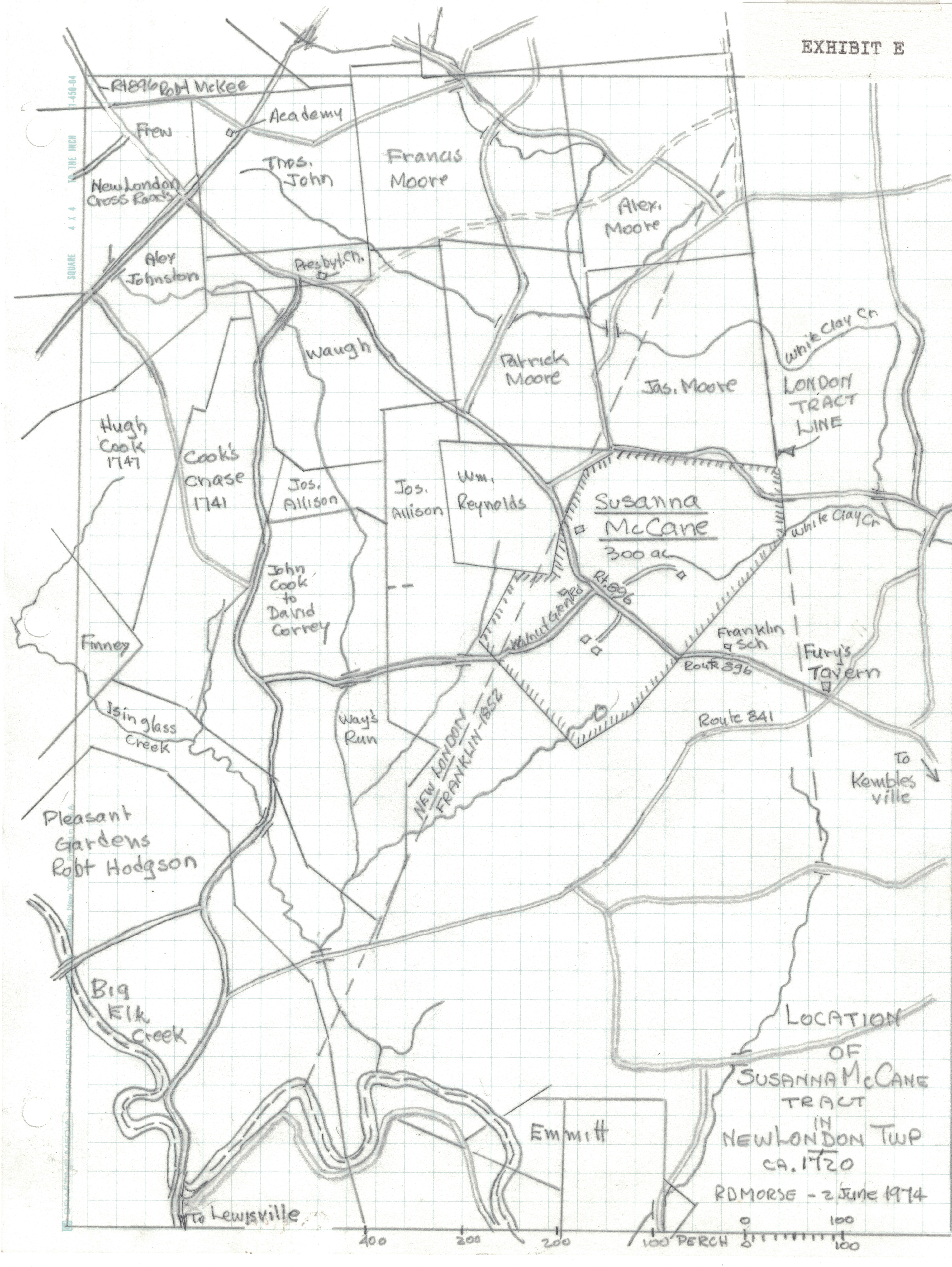
Showing the lands of Susanna McCane, or McKean, grandmother of Thomas McKean; from the New London Area Historical Society.
Detail of Susanna McCane's Lands, Early 1700s
Chillas Map of Pennsylvania, Maryland, and Delaware in 1739
Detail of Susanna McCane's Lands, Early 1700s
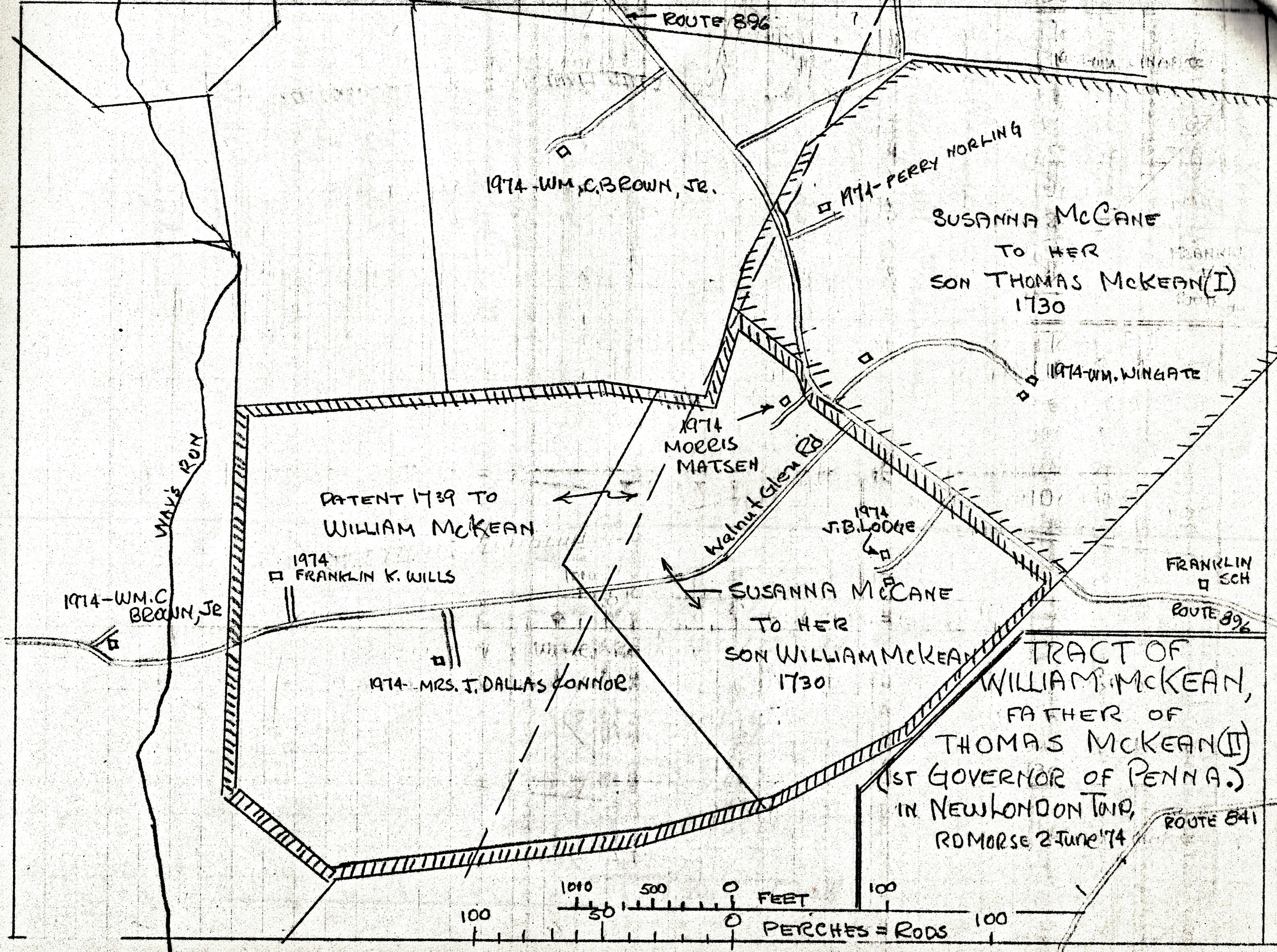
Also showing the lands of her sons Thomas and William McKean; from the New London Area Historical Society.
Lands of the London Company, Surveyed 1709
Chillas Map of Pennsylvania, Maryland, and Delaware in 1739
Chillas Map of Pennsylvania, Maryland, and Delaware in 1739
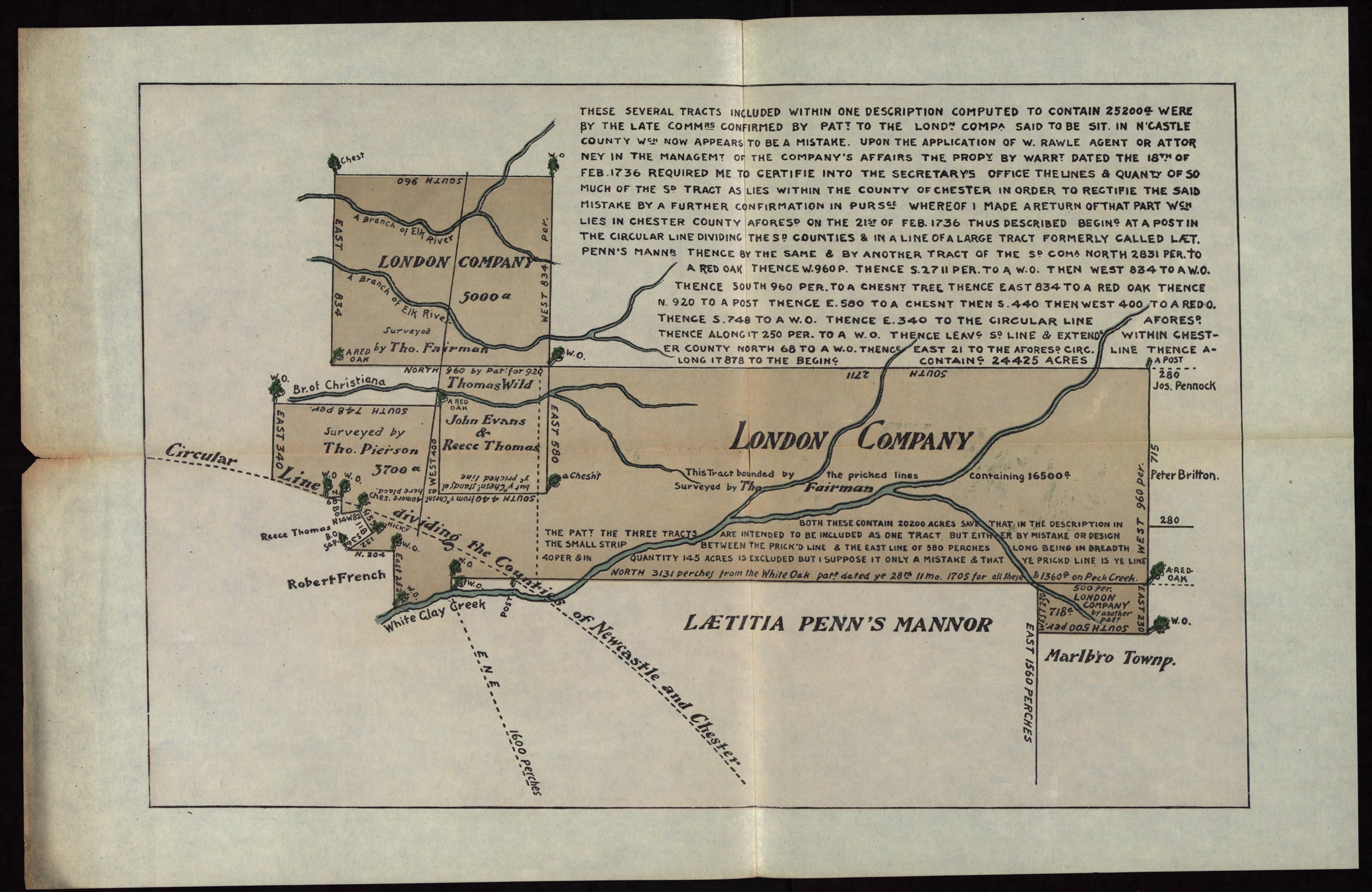
North is to the right; from the Pennsylvania Archives.
Chillas Map of Pennsylvania, Maryland, and Delaware in 1739
Chillas Map of Pennsylvania, Maryland, and Delaware in 1739
Chillas Map of Pennsylvania, Maryland, and Delaware in 1739
Showing the London Company's lands and the Nottingham Lots, rotated so that north is up; from the New York Public Library.
The London Tract and Other London Company Lands
Present-day Franklin Township with London Company Lands and New Munster
The London Tract and Other London Company Lands
Plotted on a modern relief map of SE Chester Co.; prepared by the Historical Commission.
New Munster and the Society Tract, 1763
Present-day Franklin Township with London Company Lands and New Munster
The London Tract and Other London Company Lands
New Munster, a Calvert grant, is largely in Maryland but extended into S Franklin Township. North is to the left; from the Pennsylvania Archives.
Present-day Franklin Township with London Company Lands and New Munster
Present-day Franklin Township with London Company Lands and New Munster
Present-day Franklin Township with London Company Lands and New Munster
Prepared by the Historical Commission.
Lands of George McCleave, Later of Benjamin Franklin, 1760s and 1770s
Lands of George McCleave, Later of Benjamin Franklin, 1760s and 1770s
Present-day Franklin Township with London Company Lands and New Munster
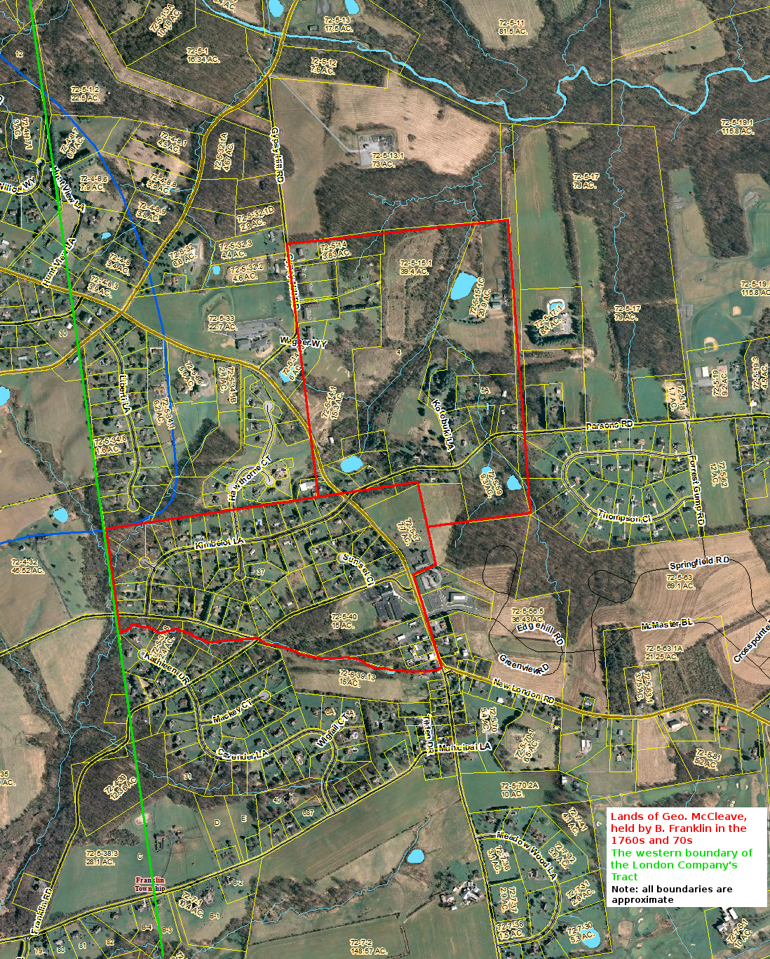
Shown on a present-day map; prepared by the Historical Commission.
Franklin and London Britain Property Owners and Roads in 1777
Lands of George McCleave, Later of Benjamin Franklin, 1760s and 1770s
Franklin and London Britain Property Owners and Roads in 1777

Part of the 1777 Chester County Atlas created by the Chester County Archives for the Battle of Brandywine project. Franklin was part of New London in 1777.
A Map of Chester County as Constituted in 1780
Lands of George McCleave, Later of Benjamin Franklin, 1760s and 1770s
Franklin and London Britain Property Owners and Roads in 1777
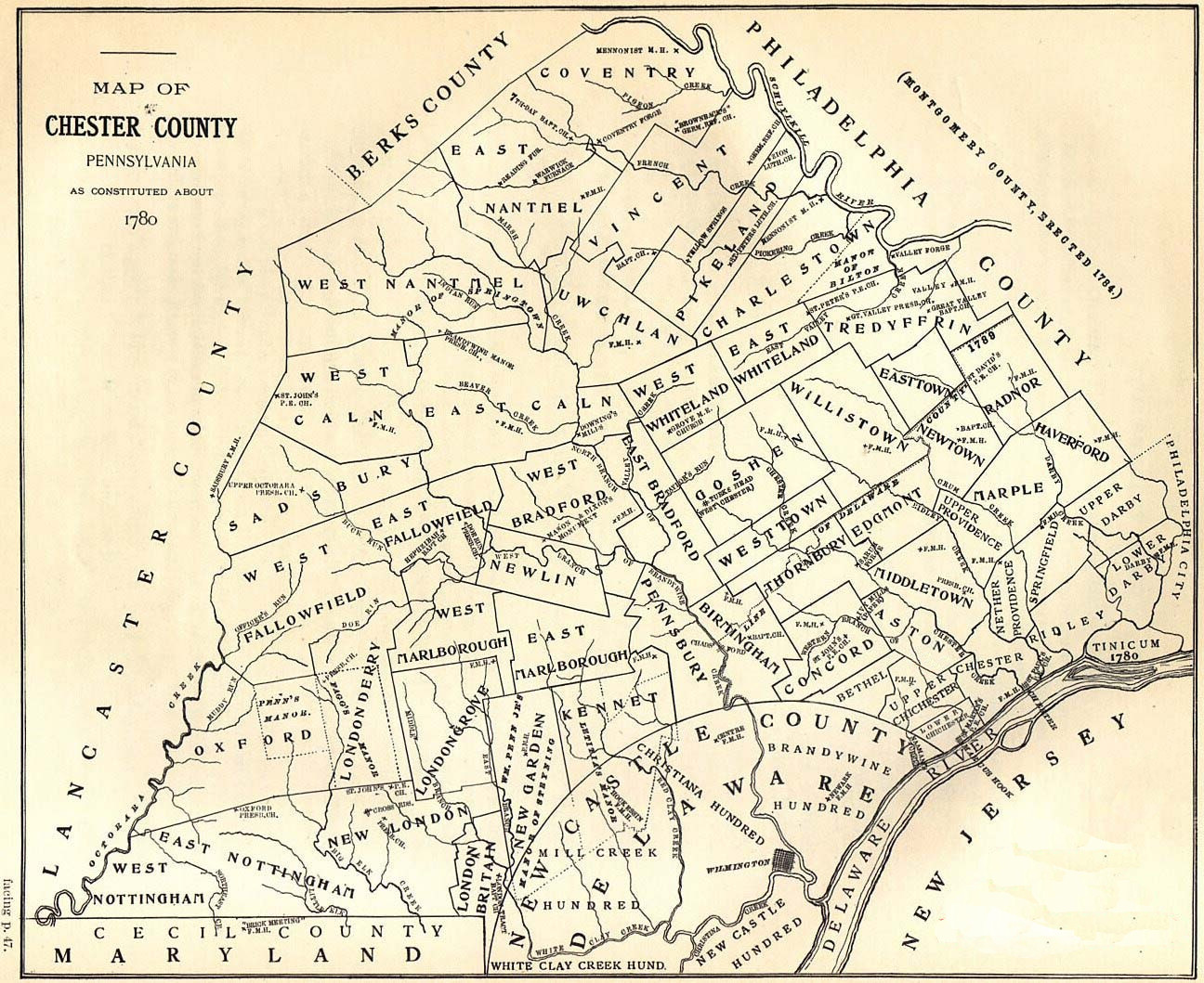
Published by Gilbert Cope in 1914.
New London Township, 1847
New London Township, 1847
New London Township, 1847
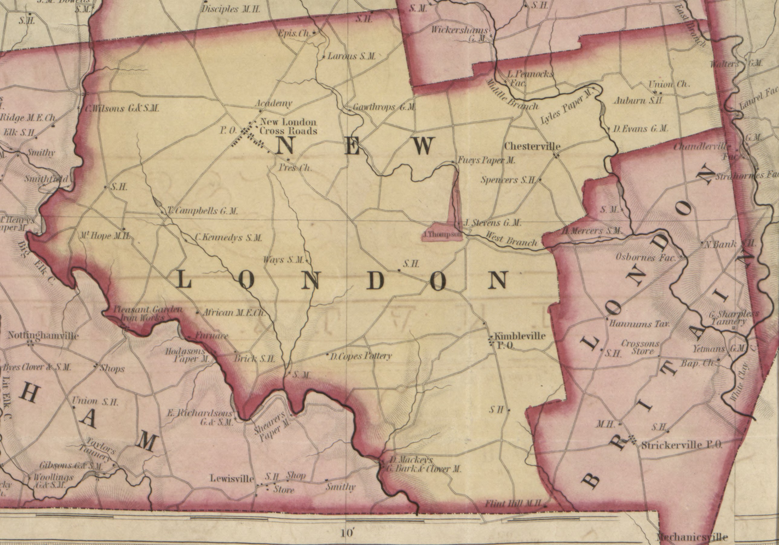
New London included Franklin Township until 1852. From the Painter-Bowen map of Chester Co. at the Library of Congress
Franklin Township, 1856
New London Township, 1847
New London Township, 1847
Detail from the 1856 T. J. Kennedy map of Chester Co.; from the Library of Congress.
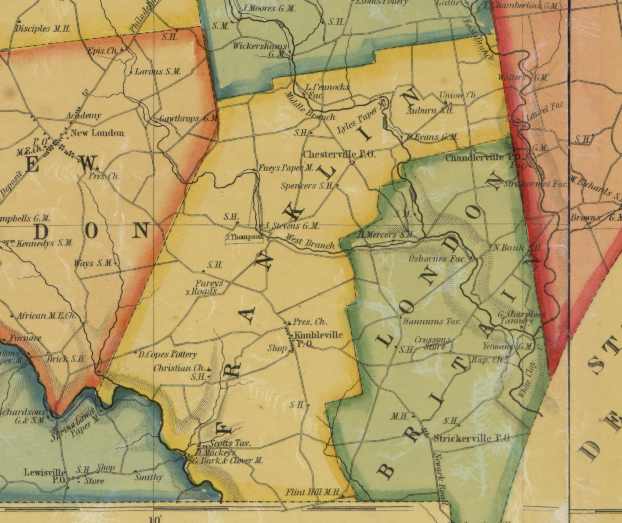
Franklin Township, 1860
New London Township, 1847
Franklin and London Britain, 1873
Detail from the 1860 T. J. Kennedy map of Chester Co.; from the Library of Congress.
Franklin and London Britain, 1873
Franklin and London Britain, 1883
Franklin and London Britain, 1873
From the Atlas of Chester County, Pennsylvania, 1873. Scan of a map belonging to a local resident.
Franklin and London Britain, 1883
Franklin and London Britain, 1883
Franklin and London Britain, 1883
From Breou’s Official Series of Farm Maps of Chester County, 1883. Scan of a map belonging to a local resident.
Kemblesville, 1883
Franklin and London Britain, 1883
Franklin and London Britain, 1883
From Breou’s Official Series of Farm Maps of Chester County, 1883. Scan of a map belonging to a local resident.
Composite Topographical Map, 1896 and 1906
Composite Topographical Map, 1896 and 1906
Composite Topographical Map, 1896 and 1906

Prepared by the Historical Commission from U. S. Geological Survey maps. The northern portion is from 1906, the southern from 1896.